


To find this trail take regional road 1-1 on the southern side of the island. In an area near the beach, you will see a bridge in the middle of a curve and a cemented road (Rua Caminho do Lugar da Praia) that ascends steeply. Walk up this road of 1,3 km and you will find a fork and an information panel indicating the beginning of the trail.
Begin your hike following the pathway on your left. Walk for about 400 metres in relatively flat terrain until you find a crossing close to a reservoir. Take a right and continue heading north. In this phase of the trail, you will notice that the steepness of the trail is increasing and that you are ascending to a higher altitude. You will find that the vegetation around you is composed of various species, of which we highlight exotic trees such as Pittosporum undulatum and Acacia melanoxylon, and some common invasive species such as Solanum mauritianum, Lantana camara and Hedychium gardnerianum.
Continue walking up, ignoring some minor detours that will appear 1 km ahead, situated in a pasture on your right side, and some derelict buildings, architectonic vestiges of a factory of defibration of Phormium tenax. Popularly known as espadana, the leaves of this plant, which you will occasionally find as you ascend further, were processed and used in the making of ropes and coarse textiles. It is said that the factory started operating in the 1920s but ended in the 1960s when its exportation was no longer lucrative.
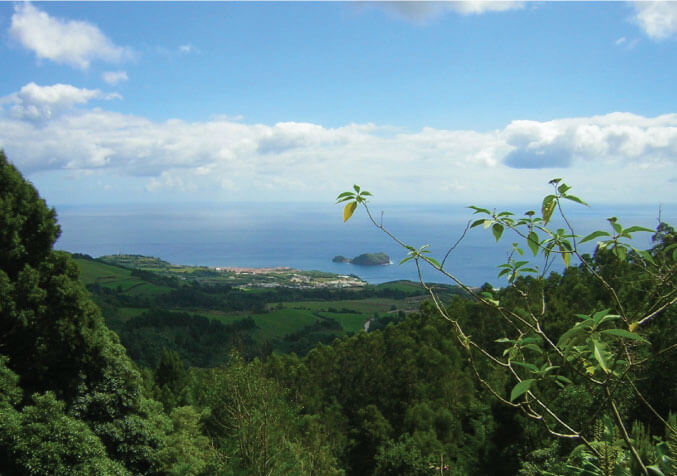
Now you are at an altitude of 300 metres and from here you can appreciate a beautiful panoramic view of Vila Franca and its islet. Follow the signs and continue walking upward. You will find some more forks on the pathway. You should veer to the left and then to the right, without leaving the main pathway. On both sides of the trail, you will see exemplars of Tetrapanax papyriferum, an arboreal species from southern China. You will also find young eucalyptus trees, a reminder that a few years ago this hillside was covered by these large trees that were used for industrial purposes. At a certain point, the trail is flanked by Cryptomeria japonica trees and the knowledgeable observer will notice some dispersed exemplars of Platanthera micrantha, an orchid endemic to the Azores. A few minutes later you will find an aqueduct built in concrete, one of the first of its kind in the Azores. The water that flows through it supplies the hydroelectric plant, Central Nova.
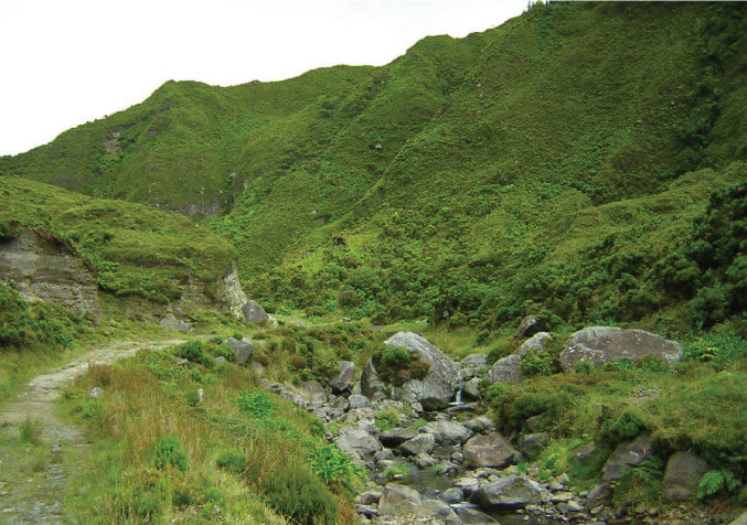
Continue walking and enjoy the incredible views of the southern coast of the island and of the southern flank of the volcano, amid exemplars of endemic species such as Vaccinium cylindraceum, Erica azorica, Viburnum treleasei, Myrsine retusa, and many others…Further, into the canal, it is possible to see some fishes that swim frenetically back-and-forth as if searching for an exit. Among these, the rainbow trout or Oncorhynchus mykiss, a species that is released annually in Lagoa do Fogo.
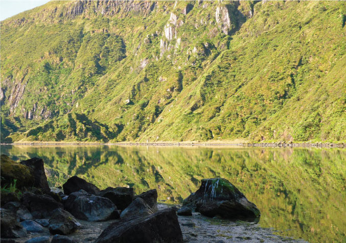
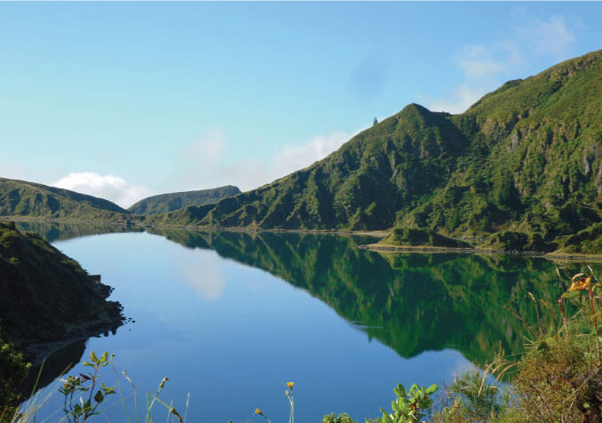
After walking 2 km, you will reach a valley with imposing cliffs, guarded by a numerous colony of seagulls (Larus michahellis atlantis) that nest here between April and May. Walk in the direction of the northern side of the volcano, passing by small structures used to extract water. You will finally reach the margin of Lagoa do Fogo, 600 metres above sea level. To your left, you will see Pico da Barrosa, the highest point of this volcanic massif at 950 metres of altitude. Now is time to rest and replenish the body with a refreshing dive in the lake. Take the same path to return.


