


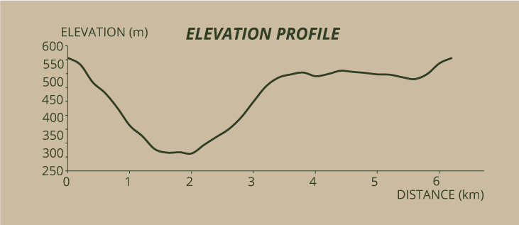
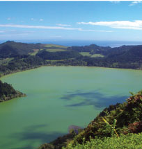
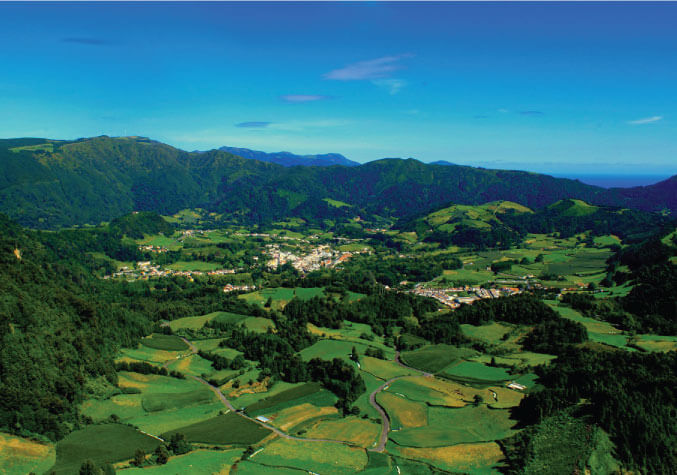
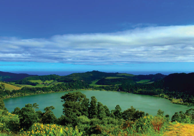
This trail begins at the belvedere of Pico do Ferro, one of the most popular belvederes on the island, offering vistas of the Valley of Furnas, with the village on the left, the lagoon ahead, and, on its margins, the zone where the famous cozido is cooked in the geysers. When visibility is good it is possible to see the island of Santa Maria on the horizon.
Begin by descending the asphalt road with the valley on your right, leaving behind the panel and the Cryptomeria japonica tree. 100 metres ahead, in the curve with a Platanus acerifolia, you will find a shortcut on your right which you must take. You will descend an improvised staircase, surrounded by bushes that cover this slope of the Valley of Furnas. We should highlight the exemplars of the endemic flora, such as Hedera azorica, Dryopteris azorica, Laurus azorica, Picconia azorica, Ilex azorica and the native Osmunda regalis.
A bit later, near a pasture, you will find a clearing from which you can view the lagoon. Continue walking on the uneven terrain and, 100 metres ahead, you will begin your steeper descent to the lagoon. Pay attention to the slippery ground. As the altitude decreases the vegetation increases in size and there is a greater prevalence of the introduced flora, such as Cryptomeria japonica and Hedychium gardnerarum.
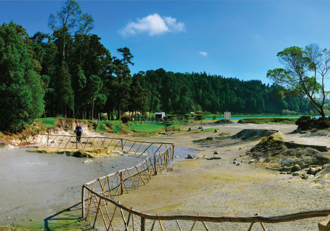
As you approach the lagoon, you will notice, on your left, the first geysers, a sign of volcanic activity. When you reach the cobbled stone road, with the lagoon ahead, you will come across some panels with information concerning trail PRC6 SMI Furnas. This is because both trails coincide in the next 800 metres. Turn right and, after passing by the car park, you will reach Caldeiras, a tourist spot where the traditional cozido (stew) of Furnas is cooked. The ingredients are placed in a clay pot or a pan and then buried on the land surrounding the geysers for about 6 hours, cooking slowly on the volcanic heat that emanates from the ground.
A few more metres ahead, near the lagoon, you shall find a panel with information regarding the Natural Park and the bird species that can be watched at this place, with their respective identification. If you are a birdwatcher this is an obligatory “hotspot” on the island of São Miguel, since you can look at most of the birds that reside in the Azores as well as some other migrating Nearctic and Palearctic aquatic species, such as Ardea cinerea and Egretta garzetta.
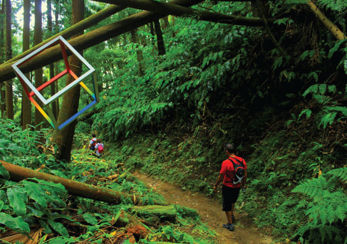
Go near the lagoon, passing by a leisure area and, as you reach the waterline, cross it by stepping on blocks that were placed there to facilitate the crossing. The dirt road ahead is surrounded by Cryptomeria japonica, keep walking for 200 metres until you find new information panels that will inform you about the distance separating to the Landscape Lab (1,1 km) and the end of the trail (4,4 km). At this point, you may also look at a small wooden sculpture which represents the hikers that walk on this part of the island.
Go up the shortcut on your right and, 400 metres later, you will reach Casa da Grená, and old proprietor’s house built in the beginning of the 19th century. In the 1980s, it was used as a holiday house of some members of the government. Nowadays it is derelict and even the old belvedere overlooking the lagoon is covered with Cryptomeria japonica. Go up the house’s staircase, go around its right side and continue walking until you reach the top of the slope.
If you feel tired when you reach the top of the slope and you wish to shorten the hike, take a right at the signpost indicating Pico do Ferro, and take a shortcut that connects the dirt road to the initial starting point. If you wish to continue and visit the Landscape Laboratory, take a left and pay attention to the signposts on the trail. Soon you will be accompanied by an endemic bird, Buteo buteo rothschildi. 500 metres later you will find a wooden bench, conveniently placed so as to you may rest for a few moments whilst enjoying a magnificent view of Lagoa das Furnas. From here onwards the trail enters the Landscape Laboratory, an area of pasture lands where several research projects are being undertaken, such as research on the ecological protection and preservation of the landscape area of the surrounding hydrographic basin. With regard to the rehabilitation of the endemic flora, we highlight such species as the Viburnum treleasei, Laurus azorica, Ilex perado ssp. azorica, Erica azorica and Vaccinium cylindraceum, among others.
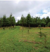
After walking for approximately 1 km in pasture land, take a right into a shortcut amid a forest called the “Enchanted Forest”. Next, cross the wooden bridge over the waterline and, in the dirt road, take a left. Cross the new bridge over the stream and walk the last 700 metres of the trail, back to Pico do Ferro.


