


Starting at the regional road, next to Belvedere do Caminho Novo, you will find the first indications on how to get to Rocha da Relva. Use the secondary dirt road that connects to the car park that was recently built for visitors. At the entry of the car park, you should consult the panel, which contains all the information you need before you begin the hike.
At the beginning of the trail that descends to the fajã, there is a small sanctuary to remind us of an old tradition of 16th and 17th century, when those that passed here stopped for a pray and left a donation. On your left, you can see the cliff of Rocha do Cascalho with a small flatter zone by the sea. You can get there via a detour that you will find further ahead.
50 metres after having begun the descent, the pathway becomes stonier, a result of the conservation work undertaken by the municipality to improve the security of the access to fajã. After some S-curves, you will find the detour to Rocha do Cascalho (1.2 km, round trip), as aforementioned. This detour will lead you to some wineries/cellars, typical houses, vineyards circumscribed in the traditional corrals of basaltic stone and to a leisure area by the sea. Return to the principal shortcut, take a left, where Morella faya, Opuntia ficus-indica and Arundo donax predominate in the vegetation. The avifauna also makes its presence felt, notably the endemic birds of the Azores, such as Turdus merula azorensis and Motacilla cinerea patriciae.
When you get to a panel called “Jogo da Bola”, you can enjoy the first view of the fajã of Rocha da Relva. On this phase of the trail, we highlight the geological sequence of different materials that recount the geological story of the different eruptive periods of the surrounding volcanos. The cliff wherein the shortcut is located presents a pattern that varies between basaltic lava flows, which resulted from effusive volcanic events, and pumice, which resulted from explosive volcanic events. Some palaeosols, with a reddish colour, reveal phases of calmness between eruptive events.
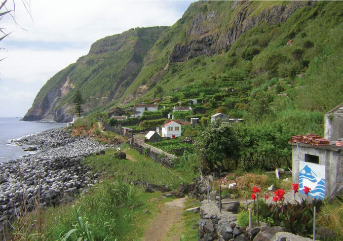
You will pass by a plaque that points to “Ladeira do Cardoso”, where the shortcut is steeper. Ahead you will find the first rural houses that served as sheds of the farms, where corn, potatoes, tomatoes and grapes are cultivated. You will pass by a small fountain, with a small welcoming message written in a panel of tiles and, after some s-curves, you will reach the fajã. This type of fajã, of detrital provenance, is very common in São Jorge and have been classified as a Biosphere Reserve. However, on the island of São Miguel, this is one of a few.
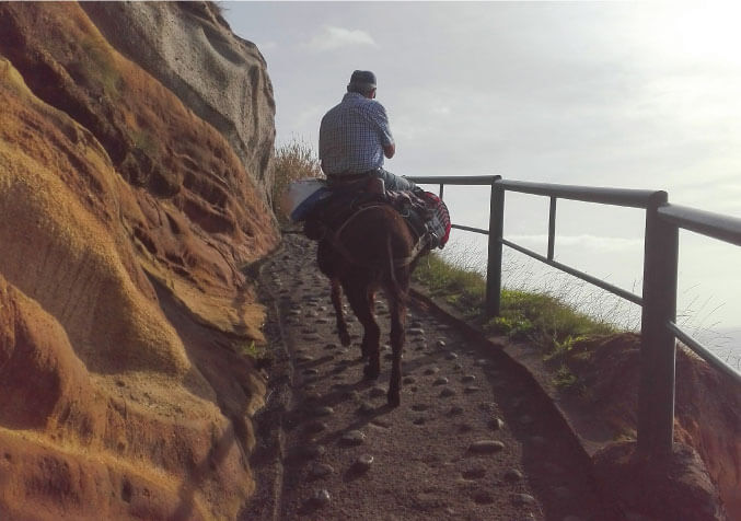
Head to the small chapel dated 15th-8-1981. Although there is no one living here due to the lack of electricity, there are a considerable number of cellars and small houses that used by some locals on the weekends and holidays. Do not be surprised if you come across a donkey or a horse since there are animals that used in the transportation of goods along the shortcut.
Take a left and go around the chapel and continue on the shortcut by the sea. Cross the bridge over the stream and observe, on your right, an entry into the cliff, called Rocha Quebrada. After the Baltazar and Lousada houses, you will pass by another fountain. On your right, observe the terraced vineyards separated by small corrals that were built using basaltic stone. After reaching the Araucaria heterophylla tree, look at the last houses of Rocha da Fajã, located at the westernmost extremity of the fajã. Given that the shortcut ends next to these houses, you will have to take the same pathway to return to the car park. Good climb!
