


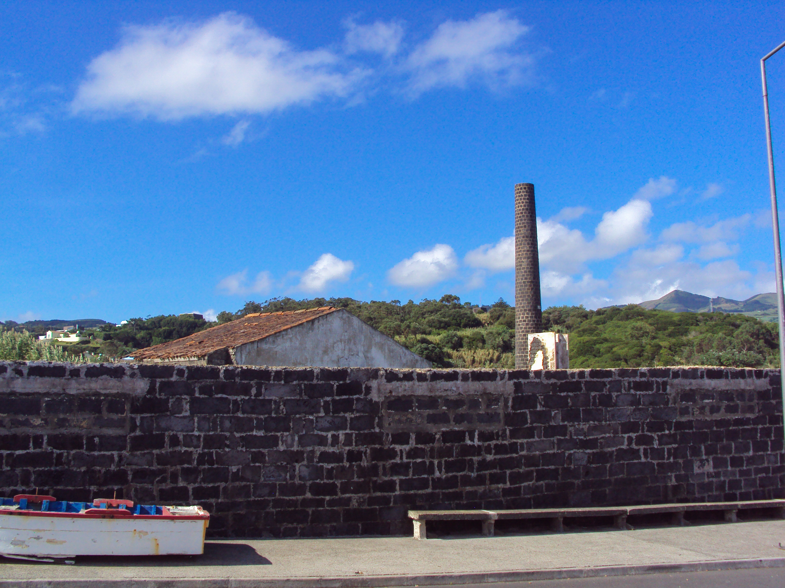
Start at the parking lot located at the oceanic pools of Poços and continue walking on the pedestrian walkway of Rua do Sertão. In the first few metres of the trail, you will find signposts with information concerning the old Whaler Factory at Poços and an ancient whaling boat. The building was abandoned when whaling ended and is now derelict. Presently, only its chimney can be seen.
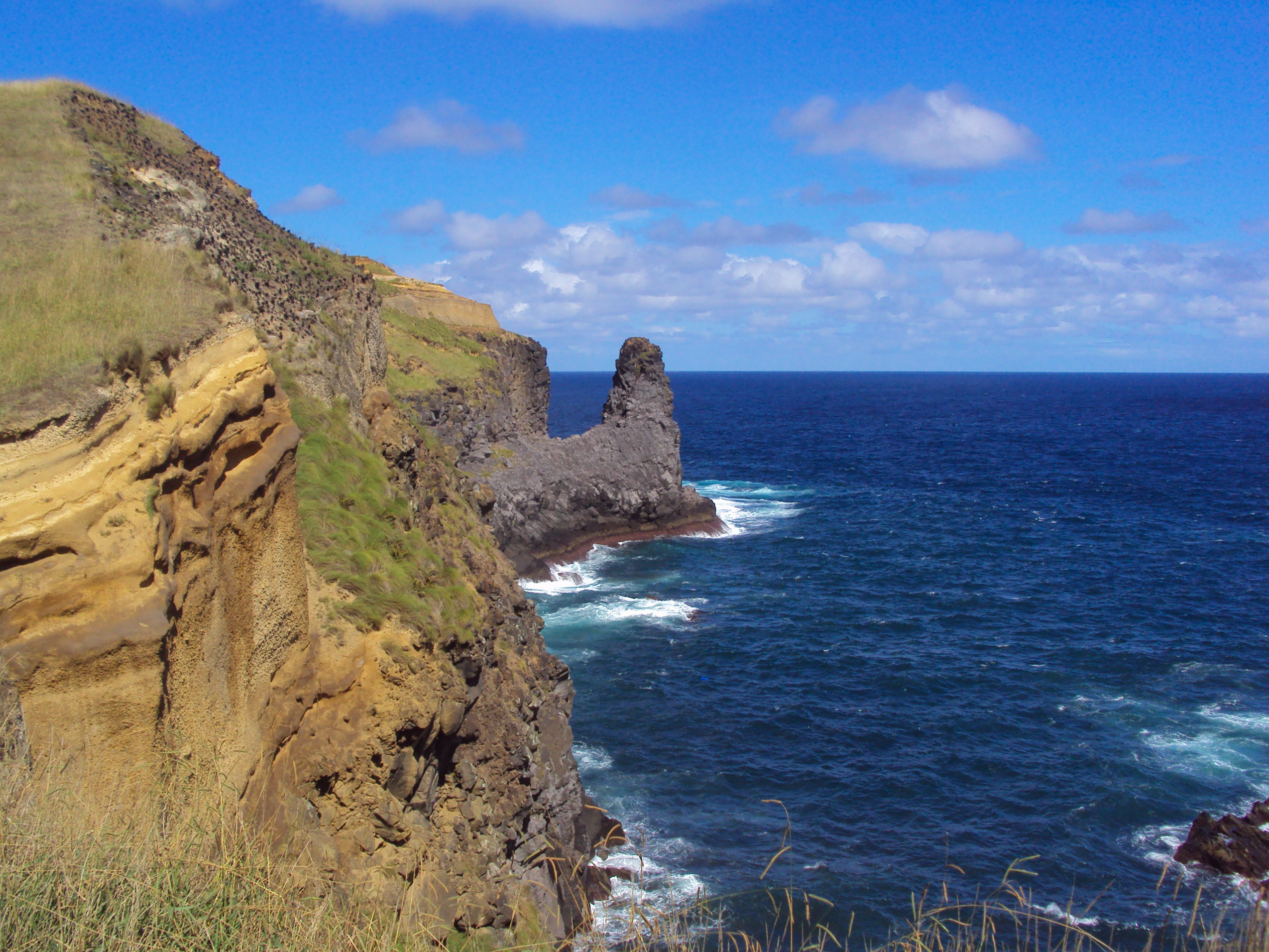
700 metres later, turn left at Canada do Ferreiro and walk towards the coastline. Pause for a moment, look westward and appreciate the interesting geological structure of the Morro das Capelas with its cone of volcanic tuffs that were formed during a very explosive phreatomagmatic eruption. It should be noted that this hill or morro is an important nesting area for several oceanic birds, such as the Calonectris diomedea borealis and the Puffinus assimilis.
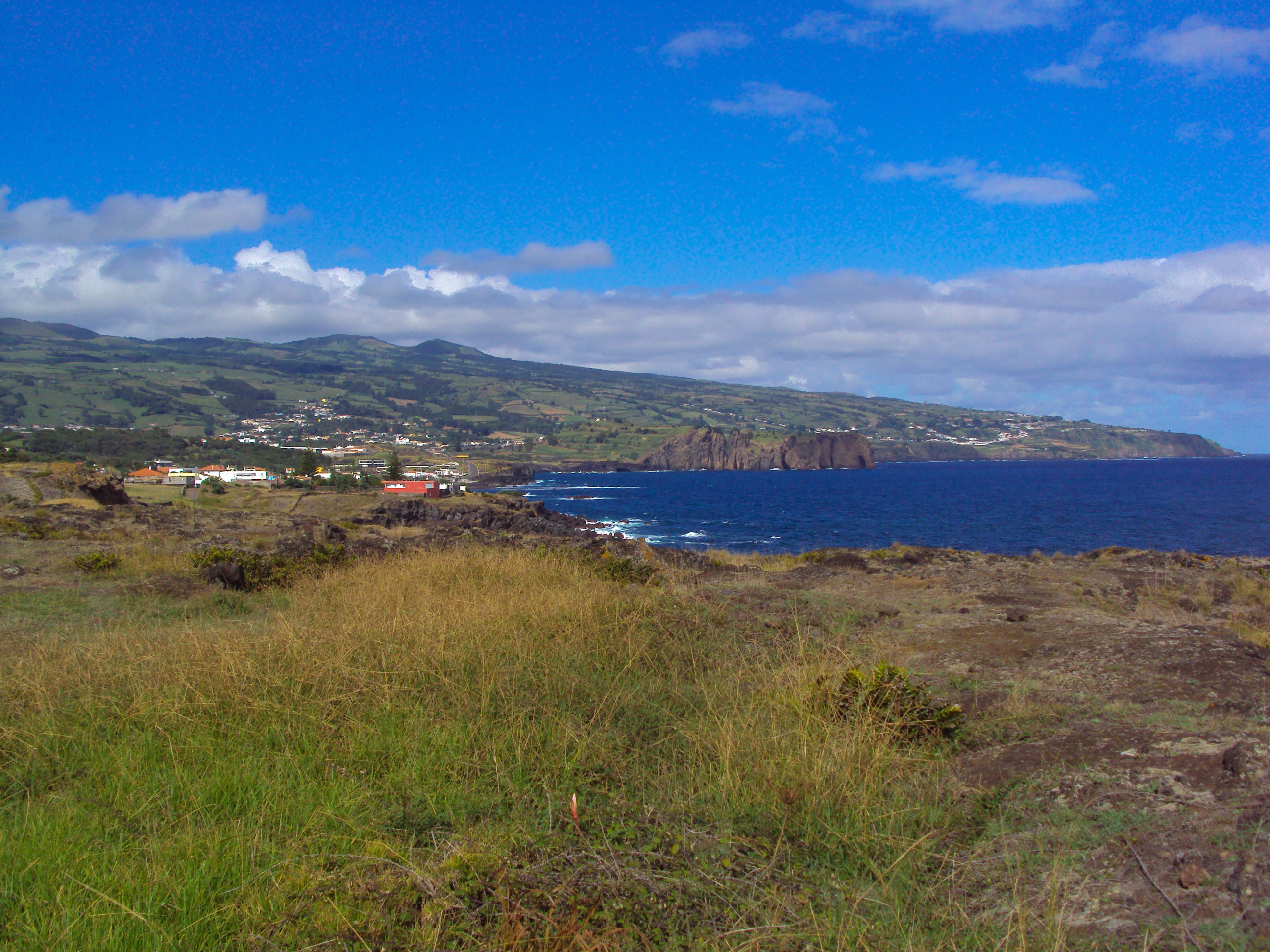
Continue walking along the coastline pathway and you will find fine exemplars of the local flora, such as the Festuca petraea and the Picconia azorica, and others that were introduced by settlers, such as the Opuntia ficus indica. 400 metres further ahead, when you reach the dirt road, take a left and head in the direction of Fenais da Luz. On your right, you will be able to easily see an alignment of volcanic cones, known as the Peaks Region. This area is characterised by the existence of an axial NW-SE zone with aligned cones of slags, from which volcanic flows descended, forming a relatively smooth inclination extending both northwards and southwards in this part of the island.
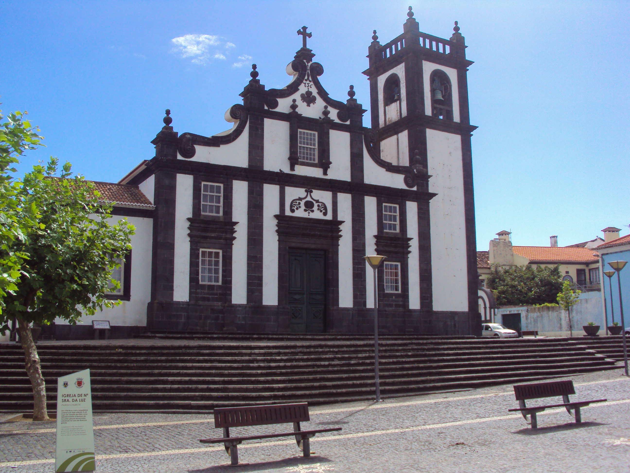
Continue on the dirt road, curve rightwards and you will be able to see the village of Fenais da Luz ahead, as well as Ponta da Calheta and, in the distance, the Mountain Range of Água de Pau. A bit further ahead you will find the Bairro de Nossa Senhora da Luz. Go left, around the houses, and take a right at Rua 6 de Junho and keep walking until you reach the regional road. Then take a left and continue walking towards the centre of the village of Fenais da Luz, where you will find the square of the church of Our Lady of the Light. The exterior architecture of this church dates back to 1756. It is considered a pilgrimage site, visited by believers that wish to thank Senhora da Luz for her divine graces.
Take a left towards Rua de Baixo and then take a right. As you walk the next kilometre, you will traverse the village, finding houses where it is still possible to see basaltic masonry. At the intersection of Rua dos Combatentes do Ultramar with Rua de São Pedro, take a right and head towards the small leisure area where you will find stone benches. You will then walk away from the houses, returning to the dirt road where cars are not allowed due to the geological instability of the steep coastline.
300 metres ahead, you will be able to visit the Chapel of São Pedro on the promontory. A relic of the 16th century, it contains an ancient image of São Pedro. From this point of high land, you will be able to see the northeastern coastline of the island.
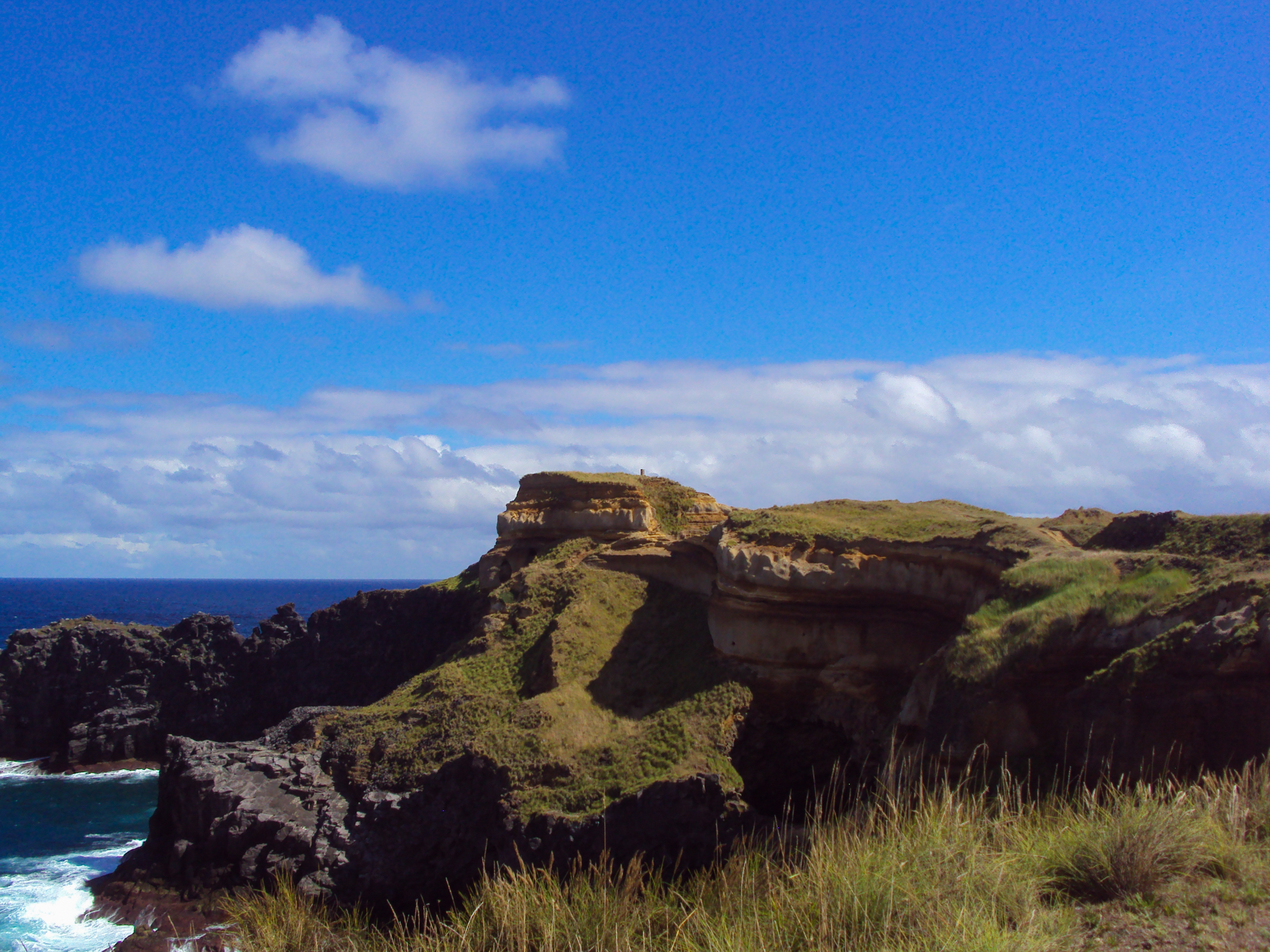
Shortly thereafter, you can take a left and head towards Buraco of São Pedro, an interesting geological formation that should be observed with great caution due to the danger of falling. After taking the detour, continue walking on the coastline that is laden with interesting geological profiles of pyroclastic and paleosol that resulted from the mix of lighter and reddish shades of volcanic flows. Bays are common in this part of the trail and are perfect habitats for some nesting marine birds that we have already mentioned.
A bit later you will reach the area of the hotel and, as you step onto the asphalt, continue walking the last 500 metres of the trail, heading towards the centre of the parish of Calhetas. The trail ends next to the church of Calhetas.


