


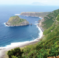
Leaving Ponta Delgada through the main path that leads to the lighthouse, you will find the small Chapel of Nossa Senhora da Guia. Make your first stop here to contemplate the João Martins islet and the island’s northern coastline. Resume your walk covering 1,5 km of the asphalt path, without ever changing direction, until you reach the stream of Moinho bridge. Make your second stop here to admire this deep valley, where the abundant brownish waters wash, as well as they can, the white rocks from the riverbed and the trout that are said to exist here. Upstream, you can also see the ruins of one of the old mills; and, downstream, contemplate the Corvo island.
400 metres ahead, you will see a concrete path on your left, known as Estrada das Lombas, which you will have to go up later. For now, keep walking and cover 500 metres more until you reach the lighthouse at Ponta de Albernaz, a structure that has been displaying its light since the 28th of January of 1925. Next to the lighthouse, keep going where the white wall extends towards the cliff and the Maria Vaz islet, classified as Natural Reserve. The flat pastures stretch to the astounding sea-beaten coastline. Ponta Delgada is located on the oldest lavas in the Flores island, with more than 2 million years of existence.
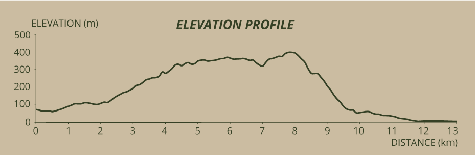
Turn around, and go back and up the abovementioned Estrada das Lombas, walking 1,5 kilometres more until you reach an altitude of 250 metres while enjoying the beautiful stream valley. There you will see a sign to your right indicating the shortcut you can take. Start walking, for you still have 2,8 kilometres ahead of you before you reach the cliff overlooking the Quebrada Nova.
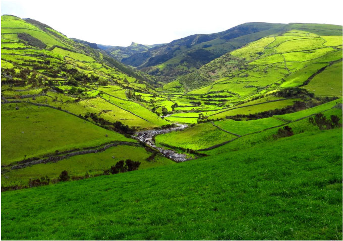
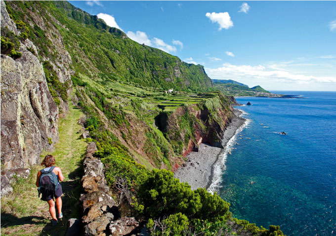
Some rocks were strategically placed here in order to even the trail’s irregular outcrops, many of which naturally grown in the form of steps. In 5 minutes, you will already be crossing the rivulet to your right, continuing to go up this uneven path, where sometimes the sun does not shine. Approximately 15 minutes later, you will emerge in a wide road, more level and easy, flanked by the pastures. These are elements of the landscape that will stretch until you begin descending the coastal cliff. You will cross streams with small waterfalls and mountain pools — where jumping frogs live — above which hang ferns and Juniperus brevifolia and Frangula azorica branches, and cover other tracks with better views, more cows, and some insects that insist on occupying the air around us.
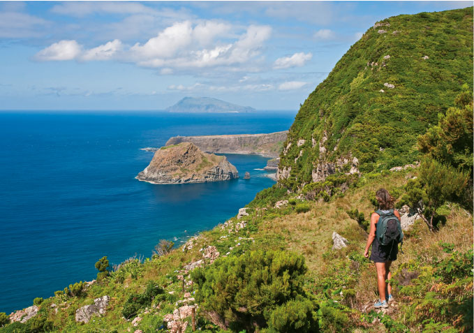
By now you have already caught sight of the aforementioned fajã of Quebrada Nova. Looking straight in that direction, further back is the Ponta de Albernaz, the Maria Vaz islet, and the Corvo island — a unique opportunity for taking some pretty good pictures. Farther away from the shore, you can start seeing the Monchique islet, a real geographic milestone that marks the end of the Old World and opens the doors to the Western Sea. You are in the Protected Landscape Area of the Central Zone and Cliffs from the West Coast.
Walk about one kilometre more and, when you reach the 430 metres of altitude, you will catch the first glimpses of Fajã Grande. A few more steps and you start descending the cliff. Do it with extreme caution, because, despite the installed support structures, namely some steps and side protections made of tree trunks as well as a wooden staircase, maximum attention is required. The steep shortcut, with Z-shaped stone parts, good for trained legs, reveals itself at each turn, and so does the landscape. Further down you realise you have entered a “shell”, formed by the imposing rocky walls, an apparently confined space, less steep, where vegetation predominantly consisting of Pittosporum undulatum and high Juniperus brevifolia protects you from the sun. For a while, the only landscape is the woods surrounding you.
When you cross this enormous “step” of the cliff and descend a little bit, the path gets less demanding, taking you to the Ponta da Fajã, which you start seeing better after each turn on the steep rock. Some water runs down the slope, a fact that would make this footpath impossible to cover if it weren’t for the human intervention. A conduit at the left side of the trail is an example of one of those interventions, made in order to channel water to the Ponta da Fajã. The Fajã Grande, with the Pico da Vigia behind, starts to seem closer and closer. It is possible that you come across some wild goats that survive in these rocks.
After the last curve, you will be able to see the Chuch of Nossa Senhora do Carmo. You enter the Ponta da Fajã through a dirt road that gives place to asphalt at a certain point. Partially affected by the cliff landslide on the 19th of December 1987, a phenomenon that destroyed a house, a chapel and a garage, the 50 inhabitants of the Ponta da Fajã were evacuated, against their will, semi-abandoning their proprieties. Not resigned to such decision, they ended up returning and reoccupying some of the houses, even though the number of permanent residents is now very low.
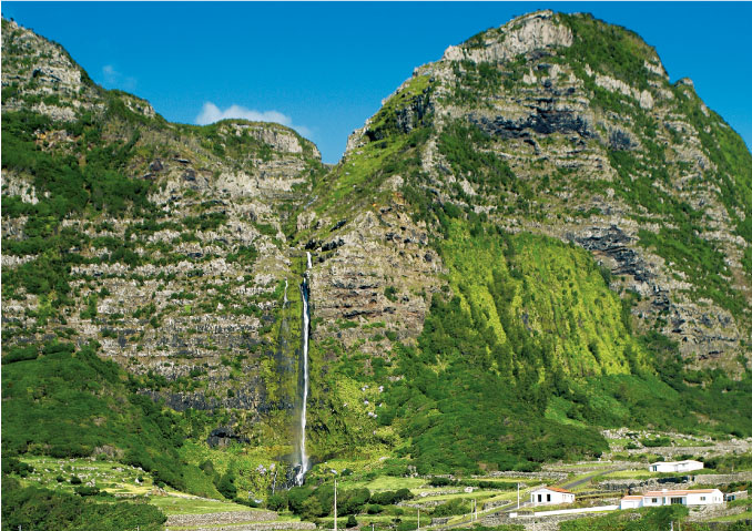
The Ponta da Fajã and the Fajã Grande bathing area (where this hike ends) are separated by approximately 1,8 kilometres of asphalt road, which, if covered by foot, allow you to admire a number of waterfalls, the last of which is the Poço do Bacalhau. In order to learn more about this waterfall and Fajã Grande, read the other two pedestrian trails that also converge at this idyllic place, where the sun and the sea meet.
