


We start by going down a dirt road, easy to walk on, but a little dusty, accompanied by the modest stream of Lombega to our right. The exposed banks show the yellowish pumice material that created the soils of this part of the island, used in the summer to grow forage maize, sweet-potato and the pastures that make them useful during the winter. Around here it is possible to observe some buzzards gliding, maybe trying to spot some young rabbit.
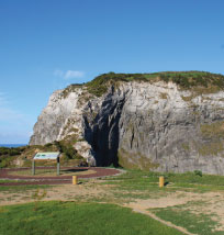
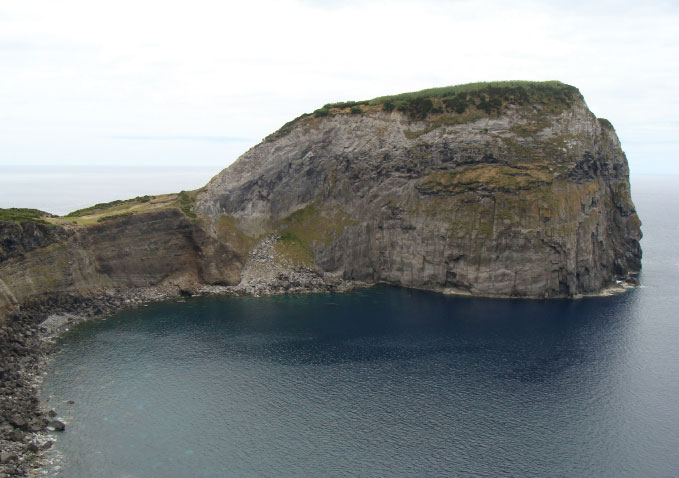
After a couple of minutes descending we pass by the first water tank. Stop to get the first glimpses over the Morro de Castelo Branco and, to your right, the tall, long cliff that ends far off in Varadouro, forming a large bay. Going down towards the coast, you will pass close to the Gruta dos Anelares entrance. This lava tube, with only 35,5 metres in total length and 3,7 metres of maximum inner height, contains ring shaped stalactites, a rare occurrence in Azorean caves that give this one its name. Visiting is conditioned and should not be done by pedestrians.
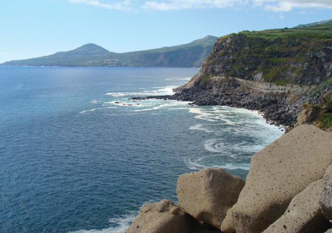
Arriving at the coastal cliff, start to turn left, continuing through a pass where certainly you will see many japanese beetles (Popillia japonica) resting on the leaves of plants. Despite its vibrant colours, this insect is actually a pest that arrived in this island some years ago and that causes some damage to agricultural crops. This cliff is in the Varadouro - Castelo Branco Protected Area for Habitat or Species Management, an extensive coastline of 99 ha that possesses natural conditions of interest for the development of specific habitats for species of flora and fauna.
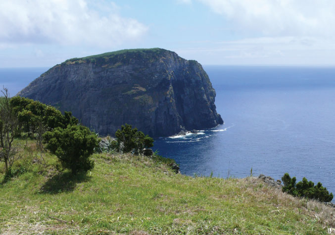
Continuing, you will arrive to the path through which the cars get here. There, a small open-air auditorium type structure was created, where you can rest, while contemplating the geological details of this imposing rock and the beautiful panoramic views, either to the side of Varadouro or to the side of Castelo Branco’s harbour. Climbing to the top is forbidden, besides being totally inadvisable due to the dangers that it entails. Be happy just to admire it and to listen to the sound of the Sterna hirundo that nest in the small cavities of the bare rock in the summer. Around here we can still see birds like the Calonectris diomedea borealis, Columba palumbus azorica and the Puffinus baroli baroli. With regard to flora, little patches of Erica azorica share the space with a meadow of Festuca petraea intensely invaded by other opportunistic species, that didn’t exist in these islands before man got here. It is still possible to find Picconia azorica, Spergularia azorica and at least one population group of Myosotis maritima protected by a fence.
On the ground, there are concrete lids. The electric current that feeds a signalling light that was placed on top of the hill, to help the air traffic heading for the airport, passes through here. Go up until the last lid, where the yellow of the pumice deposits gives place to the floury whitish of the altered volcanic rock. The outline of the coast shows the typical rugged basalt stone from denser lava flows with scoria materials.
If you saw any vehicle parked in the parking lot, you can be sure its driver didn’t go uphill, he probably went down the hill through a dangerous access on the cliff, down to the bay’s pebbles to the left of the hill, using some heather plant, a rope with knots, little prominent rocks and a lot of self-confidence. I admit that, with some surprise, I saw fishermen doing this descent.
Go back through the path, following the electricity poles and soon you will arrive at the road, next to the Império da Lombega. If you brought your own vehicle, follow the road until you reach the place where you started this footpath.

