


When you reach the end of the access road to Caldeira, before you start this trail, you can read the informative panel, that holds precious information about this magnificent geological structure and related habitats. The footpath PR7 FAI - Caminhos Velhos ends here and the GR1 FAI - Faial Costa a Costa passes through, coinciding with the first half of this tour around the Caldeira.
Even though this is a circular path, we advise you to do it in the anti-clockwise sense, starting the trail through the right. A look to the exterior shows you the hillsides of this Caldeira that go down to the sea and the majestic Pico island in all its length. The way is clearly marked on the dirt ground by the footsteps of visitors. If it is the summer, you will be able to appreciate a real aestival boom: the white of the panicles and of the ears of the gramineae, of the clovers and of the Centaurium scilloides; the yellowish flowers of the Lotus, of the Parentucellia and the Lysimachia, the purple of the Prunella and of the thymes, with many other colours and species in the mix.
Of all the species that inhabit the top of the Caldeira, it will certainly be possible to observe the Leontondon filii, Euphorbia stygiana, Tolpis azorica, Lysimachia azorica, Juniperus brevifolia – shaped by the ascending wind, Vaccinium cylindraceum, Hypericum foliosum, Ranunculus cortusifolius, Erica azorica, Daboecia azorica, Ilex perado ssp. azorica, Holcus rigidus, Angelica lignescens, Myrsine africana and Festuca jubata. The endemic moss Breutelia azorica forms dense tufts next to the balls of thread shaped webs that the endemic spider, Pisaura acoreensis, makes with curled leaves. Above all of this flies the Hipparchia azorina, an endemic butterfly with an appearance that makes any layman think of comm on moths.
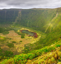
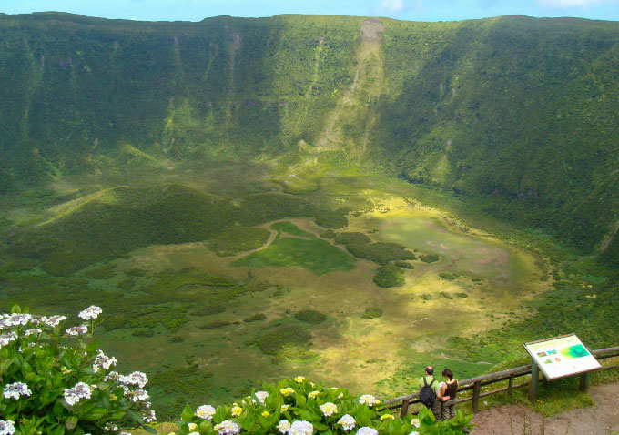
The outer hillsides of this volcano are covered in semi-natural pastures, sometimes limited by hedges of Cryptomeria, Hydrangea macrophylla or native species that use the topography to form mosaics. Actually, Caldeira is the most important biological reservoir of the island. On the inner slopes, where the cows do not arrive, the hillsides show multicoloured mountain meadows, sometimes with patches of Sphagnum sp.
Occasionally the path splits in to two parallel trails, separated from each other by two or three metres. We encourage you to always take the higher route, to not to miss the beautiful views to the exterior of the Caldeira.
You might have to share the path with some nice, multicoloured, alpine cows, that graze freely around here... in the most improbable places.
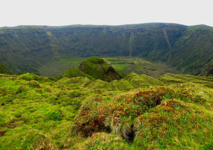
Some signs, made of tiles, fixed upon cement stands, scattered throughout this part of the trail, offer you interesting information. The first sign shows you the location of Graciosa island so that you can admire it. The second tells you that you are still in Salão parish, though on its upper limit. The third, that you’re already in Cedros parish, to which the Caldeira area belongs to, because the longest extension of the perimeter of its rim is in the territory of this parish. At the bottom of the Caldeira you will see a little volcanic cone, from a later eruption.
Arrived half way, we have in front of us the alignment of volcanoes (cabeços) that made the island grow, the last of which is the Capelinhos volcano. Great part of what you see is ranked as Protected Landscape Area of the Central Zone.
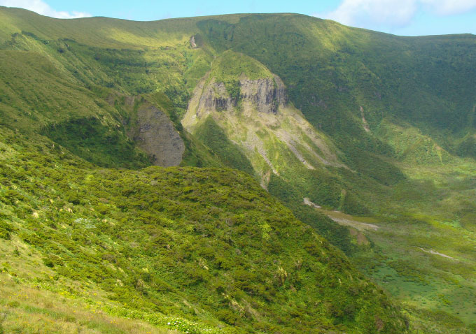
You start to see the deep grotas (=ravines) dug by the erosion into the pumice stone of the outer slope. You approach the triangulation pillar of the Alto do Brejo. Ahead, in front of the Alto do Guarda-Sol, above the trachytic dome called Altar, the inner slopes seem to have been ploughed by machines. You pass a little building in ruins... maybe a shepherd’s shelter... and you enter the asphalt road that will take you to the top of Cabeço Gordo. When you pass between the two largest antennas there, take the opportunity to get one last image of the landscape. You can already see the parking lot... go down there.

