


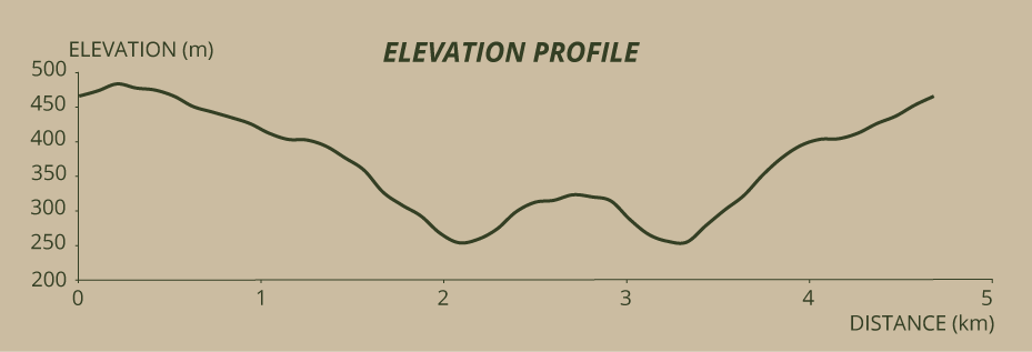
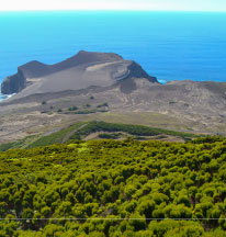
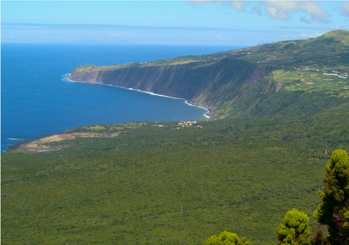
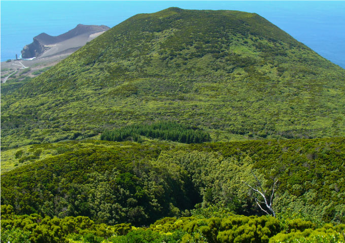
The trail starts on the top of Cabeço Verde, 488 metres high, where you can leave your vehicle. You start the walk by going anti-clockwise through the path that goes around the vegetation covered crater. Down below, the outline of the Baía das Cabras, with the houses of Fajã da Praia do Norte appearing before the cliff that stretches up to Alto da Baleia. After walking half of this way that crowns this hill, the Cabeço do Canto will appear to you in the foreground, to the northwest, and further off, the Capelinhos. Afterwards is the entire south coast of this part of the island that presents itself to us. When you finish the way around, you see, on the climb to the top of the Caldeira, the Cabeço do Fogo, formed by the historical eruption of 1672. Now it is not hard to understand that you are on an alignment of volcanic cones, the last of which is the Capelinhos, that appeared in 1958, in a path entirely inside the Central Zone Protected Landscape Area.
Afterwards, you will start a descent of 750 metres, through the secondary road that leads to Cabeço Verde. At this altitude, species like the Woodwardia radicans, a fern with large hanging leaves that mingles in the slopes with the Hydrangeas, the ivy endemic to these islands, and several herbaceous plants, are common. In the scars of the slopes along the way, we see the true nature of this volcano: under the green cover of the hills, red scoria and hard rock are hidden.
When the road turns left for the first time, leave it, following a path to the right, that will take that will take you to Furna Ruim and afterwards to the Caldeirão. You start going down using a staircase with roughly crafted rails among Ilex perado ssp. azorica, Picconia azorica, Vaccinium cylindraceum, Hypericum and Woodwardia, realizing that, to your left, the Pittosporum undulatum bush covers something dark and deep... the Furna Ruim. A small viewpoint is ready to show you a part of this creation of nature. The size of this ravine with steep and deep slopes is frightening. Right there, some moss belonging to the Neckera intermedia species, not frequent in the Azores islands, forms expressive curtains that cover and hang from the branches.
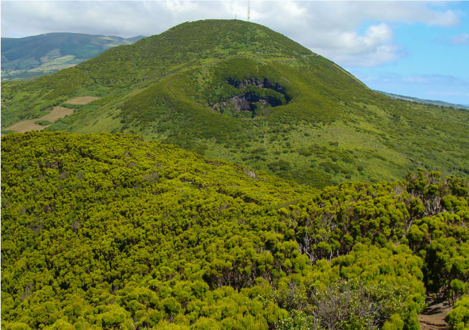
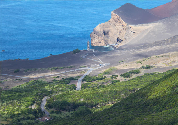
Continue under the Pittosporum undulatum for 20 metres and you will see the path splitting in two, though in reality they are the same that goes around the Caldeirão. This time go to the left, by the more shadowy part. When you reach the sunlight again, you will find a little viewpoint to your right. The crater called Caldeirão stands at your feet and the hill in front of you is the Cabeço do Canto, your next goal. In the distance, the Capelinhos volcano starts to show itself. Going around the Caldeirão, go down through a path, that is sometimes steep, until you reach the the dirt road Obeying the signals, cross the path and start a new climb to conquer the Cabeço do Canto. Go up through the tall Pittosporum undulatum and Erica azorica bush, that cast shadow on some Myrsine africana that overgrow the path and to some rare Pteris incompleta: ferns that show the peculiarity of having their leaves subdivided at the base... a characteristic exclusive to this species, at least in the Azores. Prepare yourself because the final climb of this Cabeço is steep and on slippery ground, despite the help of some wooden steps. When you reach the top go around the summit through the right, over a hard ground where practically nothing else grows. When you reach the triangulation, pillar placed on the 346 metres altitude mark, you have an exceptional panorama of the Capelinhos volcano and of the lighthouse that saw it rise.
It is suggested that, having arrived here, you take the same way back to the starting point. However, as it is possible to continue descending to the west, covering the last part of footpath PR6 FAI – Dez Vulcões you can choose to do it, continuing then to the Capelinhos Volcano Interpretation Centre.

