


This footpath starts at Alto do Chão, on the northern hillside of the Caldeira, where the road for motor vehicles ends and an upward ramp of a loose material begins. This slope will take you to a Levada (water-way) that is the reason for the name of this footpath. The trail starts here, though not the Levada, that started a few kilometres back in the opposite direction. Still, you will be walking along side it for the next 6 kilometres.
The 1998 earthquake caused significant damage either in the Levada either in the slopes upstream. About 4/5 of the Levada was destroyed, buried or overgrown by vegetation. In 2010, Faial Natural Park began restoring this historical heritage, having already recovered a great part of it and clearing the passage where it was necessary, making it possible to open this footpath in 2014. In the first kilometres, there is still some work to be done, in the final half, the Levada is at its best. It is there that you can see the water running in its stream.
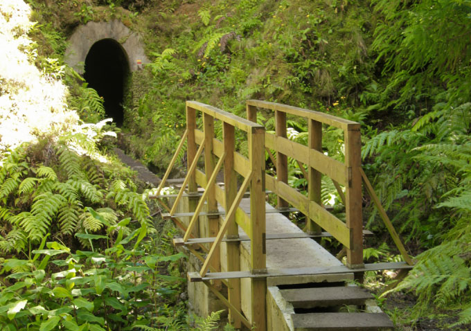
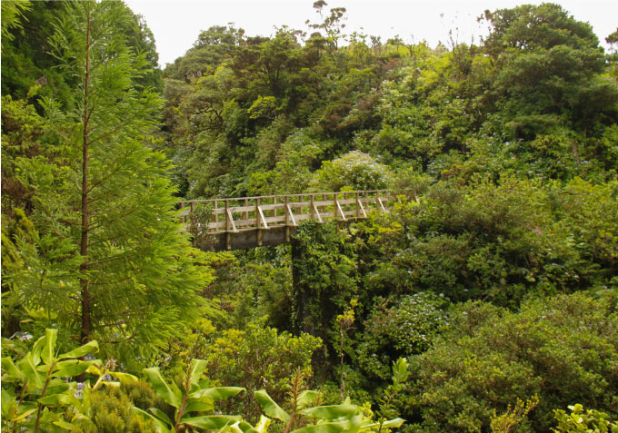
Continuing your walk, the Levada will take you alongside pastures, through woods and across bridges of a considerable height, built over the steep valleys of the main water lines. After you pass the first bridge, you will find some holes on the slope, maybe built as shelters from the rain for the workers that built the Levada. After another significantly high bridge, you must cross a tunnel that was dug through a thick layer of pumice stone, that abundantly accumulated here, as in several locations in the flank of this Caldeira volcano. The tunnel isn’t too long, but the duct in the middle of the floor forces people to walk along its sides, dragging their bodies against the walls, which might have some consequences. Out of the original four tunnels, the first of them is the only one left. The others must have disappeared in the great landslides that took place in this footpath some hundreds of meters ahead. After the tunnel, you will find one of the deepest rivers and arched bridges, where we can see again the modern structures of wood and steel that have been adapted to these old aqueducts, to allow a safe and easy crossing.
Again on the pasture you will find, here and in several places along the way, a sequence of small slabs placed at intervals over the duct. They served to help the progression of those with the mission to verify the Levada, they serve now for those who walk it for recreational purposes. They were made to be walked on, but some caution is necessary, seeing that some of them are several tens of years old.The Levada is in bad condition and totally disappears when we cross the wide valley of the main tributary of the Funda’s stream, where a large landslide, caused by the 1998 earthquake, forces the pedestrian to take a detour, only possible using the steps, ladders and handrails installed in the slopes.
You start by going down a first stairway, that is followed by a ramp of quite loose pumice stone, that requires all your attention. At the end you will turn left, going up the river’s valley. You will pass some water ducts, stacked PVC pipes, and you will arrive at a small plaque that informs the traveller about the formation of the landslides. On the opposite side, a few tens of steps were installed to take you up to find the Levada again. A little up ahead you have a new set of stairs to overcome another landslide, smaller this time.
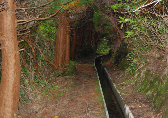
Continue walking and you will find one of the pipes that took water to the duct still serving its purpose. From there, as you go along, the Levada shows a bigger water flux, that increases with more water coming to the duct, giving a more pleasurable feel.
It is possible that you have the opportunity of seeing or hearing some of the local species of birds, such as the Scolopax rusticola or the Regulus regulus inermis. It will be easier to see other species of birds like Turdus merula azorensis, Fringilla coelebs moreletti or Passer domesticus domesticus. In respect to the flora you will be able to appreciate several communities: Laurus azorica, Frangula azorica, Ilex perado ssp. azorica, Vaccinium cylindraceum and Juniperus brevifolia. Followed by Myrsine africana, the Luzula purpureosplendens, Equisetum telmateia, Daboecia azorica and some individuals of the little Platanthera micrantha, an endemic orchid of the Azores. How one could expect from a humid and shadowy trail like this one, you can see a great variety of ferns, standing out for their size the Dryopteris azorica, Woodwardia radicans and Osmunda regalis, as well as fabulous moss blankets. You will see that some sluices appear at intervals along the Levada. They were used to redirect the water from the duct to allow the maintenance of sections downstream. In the several water lines coming down the hillside it was necessary to find solutions to prevent damage to the channel caused by the varying flow of their streams.
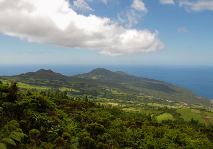
You arrive at Caminho do Brejo, the only road for motor vehicles under which the Levada passes. Up to here you have walked a little more than 4,2 kilometres, you have still 2 kilometres to go before you reach the reservoir to where this duct goes, in the section that it is better maintained. You are now inside the Protected Landscape Area of the Central Zone. You will find the most emblematic bridge of this Levada, because of its dimensions and because of the view one has over the valley from it.
Soon you will arrive at the tank or reservoir. Here the waters of the Levada are separated from the debris they carry, filling this big retention tank that feeds the hydroelectric plant.
Continue your way by going up the lapilli path in front of you until you get to a fork in the road. Take a detour, turning left, to visit the Cabeço dos Trinta. You start by going up the forest trail, to leave it higher up and follow a path through the vegetation, that will take you to an unexpected tunnel that goes through the hill, to the inside of its crater. You can go through this tunnel without light, but be careful because the floor is irregular. Once inside follow the side paths, turning right and descending to the outside through the crater’s edge. Now walk down the path to the right, coming back the same way you climbed and finishing the meters left until the end of the footpath.

